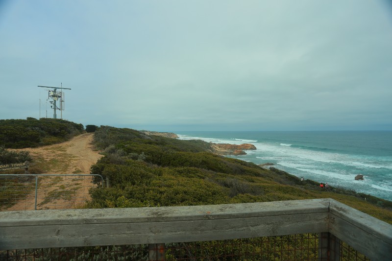
In stark contrast to the many military structures of yesteryear found throughout Point Nepean National Park, the ‘P.M.A. Radar Tower’ is a reminder of how far technology has progressed over the past 150 years.
The radar tower is instrumental in guiding shipping through the notorious ‘Rip’ that is the turbulent and unpredictable body of water that lies between the Port Phillip Heads, being Point Lonsdale to the west and Point Nepean on this side. This is the relatively small, yet only, entrance into Port Phillip Bay. The volume of water that gushes in and out of this small gateway to the bay with every change in tide, together with the rocky platforms that line the opening, has claimed many a ship, even until the modern day. Pilot boats meet ships in Bass Strait to ensure their safe passage through the heads and channels of the bay.
Located at some 29 m above sea level, the Radar Tower sits on highest point of the very western tip of the Mornington Peninsula, thus becoming quite a landmark, as well as part of many of the vistas of the National Park.
Helpful Hints:
– Located approximately 5.7 km from the Portsea Town Centre – obtain Directions here
– Accessed from Defence Road
– Located within Point Nepean National Park
– Parking at Gunners Cottage Car Park
– Adjacent to:
Discover Portsea:
– Shopping
– Facilities available at Portsea include:
Sorry, no records were found. Please adjust your search criteria and try again.
Sorry, unable to load the Maps API.


